Regional Ocean Mapping
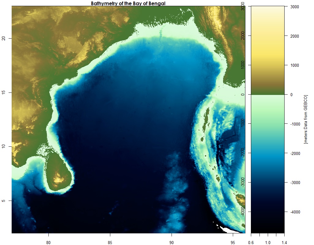
Bay of Bengal
The Bay of Bengal is a northern extension of the Indian Ocean, positioned between India and Sri Lanka in the west, Bangladesh to the north, and Myanmar (Burma) and the northern part of the Malay Peninsula to the east.
It's approximately 1,000 miles (1,600 km) wide, with an average depth near 8,500 feet (2,600 meters). The maximum depth is recorded at 15,400 feet (4,694 meters).
Numerous large river systems drain into its waters, including the massive Ganges and Irrawaddy.
Weather conditions are often brutal in the Bay of Bengal as the area is ravished by heavy monsoon rains, both summer and winter. Destructive cyclones are common in the spring and fall months, bringing intense winds and severe flooding. Because of its low-lying land, southern Bangladesh is especially susceptible to these storms.